Severe weather in the US: Heavy rain, snowstorms and flood alerts for February 26, 2025
The US is experiencing heavy rain, snowfall, and flood warnings on February 26, 2025, due to multiple storm systems moving across the country, causing travel disruptions and dangerous conditions.

The United States is facing a series of extreme weather events this Wednesday, February 26, 2025. Heavy rainfall, snowstorms and flood warnings have been issued for several regions as multiple weather systems interact, impacting different parts of the country. According to the National Weather Service (NWS), a fast-moving "clipper" system is sweeping from the Midwest to the Northeast, bringing significant precipitation. This system is causing intense rainfall in the Ohio Valley and the central and southern Appalachians. Meanwhile, parts of the interior Northeast and Maine are experiencing heavy snowfall, with accumulations expected to persist through Friday.

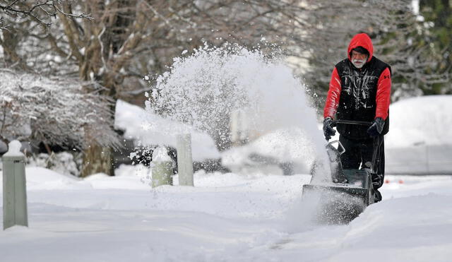
Polar vortex keeps much of the US in its icy grip. Photo: FOX 2.
Heavy rain and snow in the Northeast and Midwest US
The "clipper" system has triggered adverse weather conditions across the Northeast and Midwest. In the Ohio Valley and Appalachians, continuous rainfall is increasing the risk of flash flooding in vulnerable areas. Meanwhile, snowfall is intensifying across the Great Lakes region, Pennsylvania and New York, where accumulations could disrupt travel and daily activities.
In the western US, an incoming atmospheric river is causing significant rainfall in California, Oregon and Washington. The National Weather Service has issued flood warnings for areas with already saturated soil, increasing the likelihood of landslides and flash floods. Officials urge residents to stay updated on evacuation protocols and avoid travel in affected areas. While the Northeast and Midwest deal with rain and snowfall, much of the United States experiences unusually high temperatures for late February. In the east, thermometers will be above average, with highs ranging from 0 °C to 4 °C in New England, 10 °C to 15 °C in the mid-Atlantic, and 21 °C in the southeast.

Fast-moving, midweek storm targets northern US with snow, ice and rain. Photo: AccuWeather.
Cold temperatures and travel disruptions around the country
As mentioned, the Northeast is bracing for further snowfall and icy conditions, particularly in New England. The combination of strong winds and dropping temperatures could lead to power outages and hazardous road conditions. Authorities recommend limiting travel and preparing for possible disruptions in affected regions.
In the western US, specifically in Oregon, the Malheur River near Vale reached critical levels due to recent rains and rapid snowmelt. The NWS raised the flood warning from moderate to major, warning that the Bully Creek levee system could fail. Local authorities advised residents to prepare for possible immediate evacuation. “The Malheur River is currently at seven meters, well above the flood level of 5.90 meters,” the NWS details. The river's flow is expected to begin dropping Thursday morning. In the meantime, areas near the riverbed could experience significant flooding, especially on roads and agricultural land.


